Insider
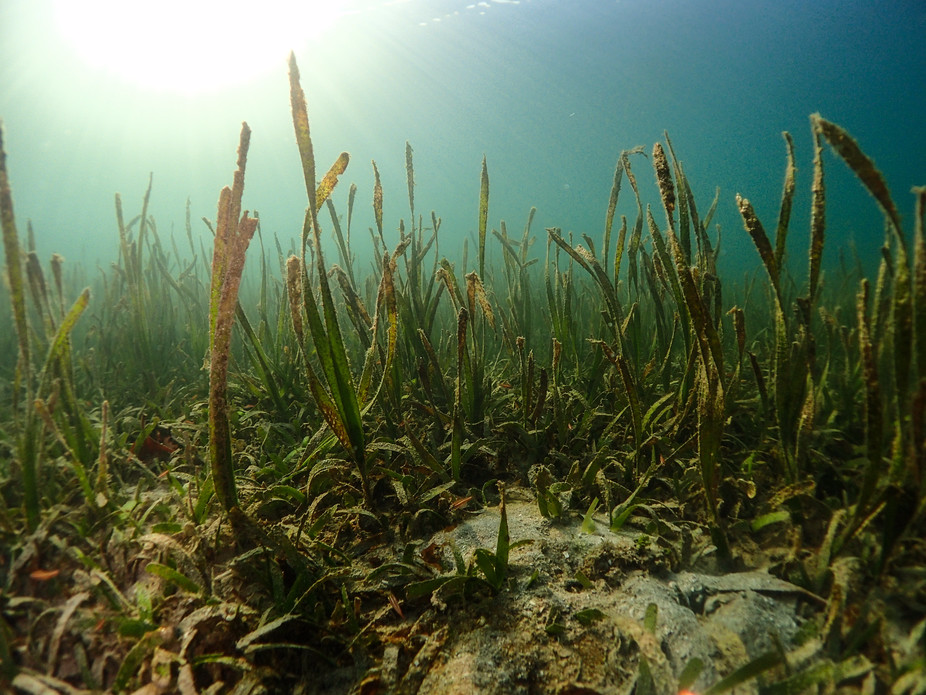
Ben Jones, Author provided
- Blue carbon stored in marine ecosystems could be crucial in the fight against the climate crisis.
- Breakthroughs in satellite technology have helped commercialize blue-carbon credits.
- But remote monitoring of seagrass, salt marshes, kelp forests, and mangroves remains flawed.
- This article is part of "The Blue Economy," a series exploring how the ocean ecosystem is being used and preserved by humanity. For more climate-action news, visit Insider's One Planet hub.
The Bahamas made history last year when it announced it was to become one of the first nations to sell credits linked to the capture and storage of carbon in its waters.
The Caribbean nation sized up its mangroves and seagrass meadows, both of which naturally trap CO2, and estimated it had about $300 million worth of assets it could sell to a voluntary carbon market littered with corporations struggling to find high-quality credits.
At the time, the country's prime minister, Philip Davis, compared the sale of blue-carbon credits to that of a waste-collection service, with the Bahamas dealing with the world's greenhouse-gas emissions — or "garbage."
One credit represents a ton of carbon sequestered or prevented from entering the atmosphere. Over $50 billion worth of carbon credits have been predicted to be traded annually in the voluntary market, according to McKinsey.
Blue carbon, which is stored in coastal and marine ecosystems, has become an increasingly important asset in the fight against the climate crisis. It could represent one-fifth of the emissions reductions needed to keep within 1.5 degrees of warming, a 2019 report from the World Resources Institute found.
Coastal and marine ecosystems such as seagrass, salt marshes, kelp forests, and mangroves also help mitigate the effects of climate change, namely coastal erosion, sea-level rises, and floods, while providing a habitat for marine life. Green carbon, by comparison, is stored on land, usually in woodland projects.
One thing the Bahamian effort is missing is "data and scalability," Dimos Traganos, a scientist with the Global Seagrass Watch, told Insider. His organization is building a seagrass- and seascape-monitoring service, which he said would plug that gap.
It uses cloud computing, artificial intelligence, and satellites to monitor and verify the health and carbon storage of marine ecosystems, the latter being the basis of blue credits.
The blue-carbon ecosystem is leaning heavily into these technologies in an attempt to avoid the accuracy and verification issues that have plagued terrestrial projects.
Tech advances like 'going from dial-up internet to 3G'
Satellites have hit a "tipping point" and have unlocked blue carbon, according to Guy Wolf, the founder and director of the Oxford University spinout OxCarbon.
"It's a bit like going from dial-up internet to 3G," he said.
His nonprofit aims to bring transparency to carbon projects, including a mangrove project where satellite images are linked to visible forest characteristics and soil-sample data to establish quantities of blue carbon stored.
Satellite monitoring is already established on land, where it's used to determine tree types and the size and maturity of a forest without having to manually collect data, which makes it more scalable. This is all fed into a machine-learning model, along with other data, to estimate how much carbon is stored and how much could be stored.
But it was difficult to differentiate degraded forest from mature forest over large sample areas, Wolf said. This affected the accuracy of carbon estimations. Older technology provides 30-meter resolutions, meaning every pixel on a picture is 30 square meters, so the area that can be looked at in depth is limited. Older satellites also don't show microchanges year by year, so by the time an issue occurs, it's likely too late, he added.
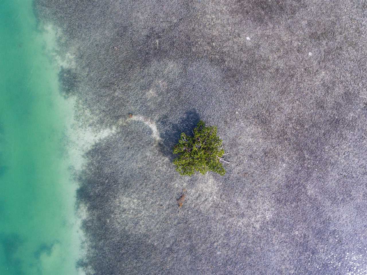
David Gross/ Ocean Image Bank
OxCarbon uses 50-centimeter resolution, which, together with advancements in computing power, means that the level of accuracy is now an "order of magnitude greater" across larger areas, he said.
"That's obviously a very scalable solution because even if the area is 10 times the size, you don't need extra manpower," Wolf said.
"It would cost a bit more, as you would need a bit more satellite imagery, a bit more computer processing, but that is a scalable solution that can expand 100,000 hectares," he added. "It is fast because once you've got the images, you process them."
Carbon credits can then be verified and issued faster. "It's speed, accuracy, and scalability, all in one go," he said.
With an abundance of satellites in orbit, photos can be snapped "every month, week, or whenever the satellite flies over," Thomas Merriman, a cofounder and the chief product officer of the carbon-credit-insurance provider Kita Earth, said. His company is betting on the quality of carbon projects, ensuring buyers receive the credits they buy even if something goes wrong.
But the work is easily disrupted by cloud cover, which blocks the ability to take photos.
Combating the clouds
Mapping technology that can break through clouds is often attached to satellites. For example, light-detection and -ranging technology can even penetrate water to map the seafloor or coastline, measure the marine environment's features, and survey its vulnerability.
"The challenge with anything that's under the water is the turbidity of the water. It's great if you've got really clear crystal waters. It is very bad in the UK," said Donna Lyndsay, the sustainability lead at the UK's mapping agency Ordnance Survey, which has worked with mangroves in the Middle East. Satellite data has to be paired with sonar, divers collecting information, or other field data, she added.
Indeed, the Global Seagrass Watch combines its remote-monitoring data with field data. "There are 70 seagrass species. You cannot monitor all of them from space because some of those would be very, very sparse, very coarse, be sitting in turbid waters 20 to 30 meters deep," Traganos said. It's always important to ground-truth findings, he added.
Carbon as a 'blunt tool'
The end goal for many of these projects is to find and highlight hot spots of blue carbon and biodiversity to influence protection, conservation, and climate agendas. Traganos sees the Global Seagrass Watch slotting into an ecosystem of other projects that collectively help to monitor and protect the marine environment.
Carbon is sometimes "a bit of a blunt tool," Kita's Merriman said. There's a wealth of data to unlock outside it; Merriman wants property developers to value the flood-defense services of mangroves, for example. "That's the next frontier, really," he added.
Merriman also predicted the emergence of biodiversity credits, which would help to restore natural habitats.
Pivotal
"If you do right by nature, by biodiversity, there will be carbon benefit, either by storage or sequestration," Zoë Balmforth, an ecologist turned founder, said. Her company, Pivotal, conducts biodiversity surveys, including in coastal areas. "But the reverse is not always true. It can be true, but it's not always," she added.
Cameron Frayling, Balmforth's cofounder, added: "Technology is the enabler that makes measurement scalable, but you still have to go on-site to deploy it. It's the same thing as on land. We can't do all of this by flying above something and taking pictures, whether it's lidar or satellite."
Read More
By: [email protected] (Tasmin Lockwood)
Title: High-powered satellites have made blue-carbon credits a reality. But they still face accuracy and scalability issues.
Sourced From: www.businessinsider.com/satellite-advancements-unlocked-blue-carbon-biodiversity-2023-7
Published Date: Thu, 10 Aug 2023 14:01:19 +0000
Did you miss our previous article...
https://trendinginbusiness.business/business/small-businesses-resilient-engines-of-economic-activity
.png)
